Home / Anglais / Shows / The Atlas of the Anthropocene

The Atlas of the Anthropocene

The Atlas of the Anthropocene is a collection of cartographies of the world’s upheavals.

The Atlas of the Anthropocene is a collection of cartographies of the world’s upheavals.
Each cartography is a creation based on specific fieldwork. It thrives on investigations, meetings and discussions with experts of the mapped spaces and studied topics.
Thus, each cartography brings into play a territory.

Each cartography asks a central unresolved question. This is what I call the cartography’s axial issue. The question is essential. Without the question, there would be no cartography.
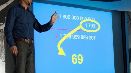
Each cartography develops a reasoning based on a hypothesis. For that purpose, it uses very efficient presentation tools.
Each cartography also has a special moment, which I often call “the ontological break”. However, the ontological break isn’t automatic.
Each cartography provides one or several answers to the original question. The answer can be a true answer or a new question. But whatever the answer, there is always one. Because a cartography with no answer isn’t a cartography.
Each cartography lasts around one hour. But it’s never easy to say everything in an hour.

All the cartographies have the same structure. Only the content varies (because the content always depends on the question asked). Each cartography requires: one large screen, one powerful video projector, one computer, one microphone headset, one table and one flipchart with a white surface for dry wipe markers (but not systematically, it depends on many things, especially on the flipchart with a white surface for dry wipe markers).
The cartography device is easily adaptable to various kinds of places.

The first cartography was created in 2010. The total number of cartographies in the Atlas is still unknown.
It can therefore be said that the Atlas of the Anthropocene is a project in development.
Or that it has no end.

Atlas:

  • Greek giant, Titan. Atlas has to carry the celestial vault on his shoulders (the punishment that Zeus imposes on him in order to punish him for his participation in the war between giants and gods).
  • A mountain range in North Africa
  • The first cervical vertebra that supports the head
  • A set of geographical or astronomical charts

The Anthropocene:
Referring to a new geological era, the Age of Man, which would have started in the eighteenth century, and is characterised by the fact that Man might have become the main agent of the planet’s evolution. With the Anthropocene, it can be said that Man is meeting Earth’s History, and this encounter generates a lot of new things, that I like to put into cartographies.

Frédéric Ferrer

The cycle
7 projects

The Rabbit Issue, cartography 7

Creation 2021

From the rabbit hutch to factory farming, from the invasive species that has destroyed many ecosystems to the resistance fighters on the Kerguelen islands, from the rabbit sent into space in 1959 by the Russians to the victims of the Côtes-d’Armor serial killer, from the stuffed animals that (...) Read more

About Cod, cartography 6

creation 2017

Cod is a fish - or rather a family of fish, because there are many different species of cod – that lives in the cold waters of the northern hemisphere, and whose flat tail inspired the design of an elegant tailcoat, known in French as “queue-de-morue” (“cod-tail”), not to be confused with the other (...) Read more

WOW ! cartography 5

Creation 2015

The human species only has a limited amount of time. With the Anthropocene draining the planet, irreversible climate change, the inevitable threat of asteroids which would cause a further mass extinction of biodiversity, intergalactic collision, the reversal of the magnetic field or the (...) Read more

North Pole, cartography 4

Creation 2013

The North Pole is one of the world’s areas of acceleration. Observing and analysing it is surveying a future territory, it’s like looking at the place where the Earth’s fate is unfolding in present time. Mankind urgently needs to understand the changes that are taking place in these areas of (...) Read more

The Deterritorialization of the Vector, cartography 3

Creation 2012

The vector is Aedes albopictus, alias the tiger mosquito. This mosquito is named “tiger”, because it is striped, and it is a vector, because it transmits viruses. Originally from Asia, it is now spreading throughout all continents and constitutes a significant health hazard for millions of human (...) Read more

Vikings and Satellites, cartography 2

creation 2010

A thousand years after their first migrations, Vikings are still wreaking havoc in the world. Their “experience” of climate change and their legacy are now the subjects of interpretations that are dividing the scientific community. Can satellites help us understand the battle at stake ? What do (...) Read more

In Search of the Lost Ducks, cartography 1

Creation 2010

In September 2008, the NASA dropped 90 yellow rubber ducks in a glacier in Greenland in order to estimate the rate of climate warming. Awaited for a few weeks later in the Bay of Disko, the ducks never reappeared. Where did the ducks go? Were they trapped by a glacier? Did they already get out? (...) Read more

Share
  • Facebook – LinkedIn — Twitter – Mail